Teachers Can Attend Course of Satellite Imagery at INPE
Hello reader!

It follows a note published on the day (04/13) in the
website of the National Institute for Space Research (INPE) noting
that teachers can attend course on the use of
satellite imagery as a teaching resource.
Duda Falcão
Teachers Can Attend Course on the
Use of
Satellite Imagery as a Teaching Resource
Friday, April 13, 2012
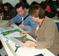
The course on
“Scholar Use of Remote Sensing for Environment Studies” is now open for
registration. It will take place at the Brazilian National Institute for Space
Research (Instituto Nacional de Pesquisas Espaciais - INPE), in Sao Jose dos
Campos, SP, Brazil, between July 16 and 20.
Training
teachers in the use of satellite images and geographic information is a
tradition at INPE, which every year welcome teachers of the elementary and high
school from all Brazilian regions.
Remote Sensing
is now considered essential to prevent deforestation and to support crops
forecasting, among other applications, moreover can help teaching some
subjects, such as geography, science, physics, chemistry and history. The use
of new technologies makes the classes more creative and contributes to arouse
student’s interest.
The course
consists of classroom and practical activities, and a site visit at INPE. The
program includes different kinds of sensors and satellites, also how images
take form, cartographic scale and other issues. Examples of the scholar use of
satellite images, as well as the space technology application in agriculture,
in studies of the urban space, vegetation and watersheds will be presented.
Registration
should be completed at: www.dsr.inpe.br/vcsr
Source: WebSite
of the National Institute for Space Research (INPE)
Comentários
Postar um comentário